Moving Light: Satellite, Plane, or Drone?
The pattern of motion, flashing cadence, and shadow fade matter far more than apparent size.
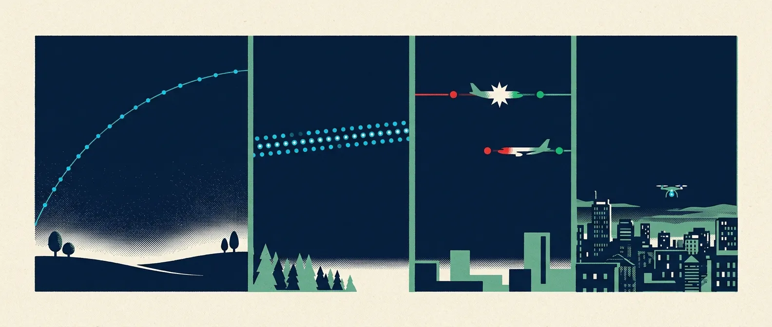
- Smooth and silent points favor satellites. LEO satellites cross the sky in 3–15 minutes at ~0.3° to 1.1°/s with a steady, unblinking beam.
- Rhythmic strobes mark aircraft. Federal regulations mandate red/green navigation lights and anti-collision strobes flashing 40–100 times per minute.
- The shadow fade is a definitive clue. A satellite entering Earth's shadow dims to deep orange and vanishes in 2–5 seconds mid-sky.
- Linear trains indicate new satellite launches. Starlink and Qianfan release 20–60 stacked satellites that march together before spreading out.
When you see a point of light traveling across the night sky, its motion and optical behavior reveal its true identity. Satellites glide silently along unalterable orbital arcs; airplanes display strictly regulated flashing strobes; drones execute sudden hovers and sharp turns; balloons drift slowly on local winds.
If the object is stationary or twinkling, consult our star-versus-planet guide. To classify a moving light, use this breakdown of angular speeds, shadow geometry, aviation laws, and constellation train mechanics.
Angular velocity: how speed and altitude reveal the object
Apparent angular velocity (measured in degrees per second, °/s) is the rate at which an object crosses your field of view. By Keplerian orbital mechanics (v = √(μ/r)), a low Earth orbit (LEO) satellite at 400 km altitude travels at roughly 7.66 kilometers per second, yielding a maximum zenith angular speed of about 1.1°/s.
| Object Classification | Typical Altitude | Apparent Zenith Speed | Pass / Event Duration |
|---|---|---|---|
| LEO Satellite (ISS) | 400 km | ~1.1 °/s | 3 to 7 minutes (15 min max) |
| LEO Satellite (Medium) | 800 km | ~0.5 °/s | 10 to 14 minutes |
| LEO Satellite (High) | 1,200 km | ~0.3 °/s | 15 to 20 minutes |
| Geostationary (GEO) | 35,786 km | 0 °/s (Fixed) | Continuous (requires optics) |
| Commercial Aircraft (Cruise) | 10 km (35,000 ft) | ~1.4 °/s | 3 to 5 minutes |
| Aircraft (Radial Approach) | 1 to 3 km | 0 to 5+ °/s | 1 to 3 minutes (appears fixed head-on) |
| Consumer Drone | <120 meters | 0 to 10+ °/s | 15 to 30 minutes (battery life) |
| High-Altitude Balloon | 30 km (100,000 ft) | ~0.05 °/s | Hours (wind drift) |
Cruising commercial aircraft (~1.4 °/s) and LEO satellites like the ISS (~1.1 °/s) share similar zenith angular speeds. Therefore, angular speed alone cannot separate a high-altitude plane from a satellite.
However, trajectory physics provides absolute resolution. Satellites travel in straight, unalterable Keplerian arcs across the sky. Any light that halts, hovers, or executes sharp directional turns is strictly atmospheric—usually a drone or helicopter.
Illumination geometry and the mid-sky shadow fade
Satellites do not produce their own visible light; they shine exclusively by reflecting sunlight. This reliance creates a rigid visibility geometry: the ground observer must be in darkness, while the satellite at high altitude remains in direct sunlight. This window peaks during astronomical twilight, when the Sun is between 12° and 18° below the horizon.
Sunlit Orbit
- Reflects steady solar rays
- Unblinking white or yellow point
- Smooth speed across background stars
- No red or green navigation lights
Umbra Shadow Entry
- Crosses into Earth’s shadow cone
- Solar disc eclipsed over 2 to 5 seconds
- Turns deep reddish-orange during ingress
- Smoothly fades to complete invisibility mid-sky
The “fade to nothing” signature is decisive. When an eastward-bound satellite crosses into Earth’s umbra, its solar illumination is severed. Over two to five seconds, the light dims, reddens as sunlight refracts through Earth’s atmosphere, and vanishes completely mid-sky. Aircraft never turn off their mandatory navigation lights mid-flight; if an unblinking light extinguishes in clear open sky, you have witnessed a satellite entering Earth’s shadow.
The International Space Station: orbital brightness record holder
The International Space Station (ISS) is the largest human-made structure in orbit, spanning 109 meters across its truss and featuring 2,247 square meters of highly reflective silicon solar arrays across eight solar wings.
Orbiting near 400 km altitude, an overhead pass brings the ISS to its closest distance. On average passes, it reaches an apparent magnitude of −2 to −3. Under optimal specular glint angles—where its massive solar arrays mirror sunlight directly to Earth—the ISS can reach a peak magnitude of −4.5, outshining Jupiter (−2.9) and rivaling Venus at its brightest.
A high-elevation pass takes 3 to 7 minutes end to end. Low-elevation passes (skimming 15° above the horizon) increase slant range beyond 1,000 km, dimming the station to magnitude 0 or +1 due to distance and atmospheric extinction.
Satellite trains and mega-constellations: Starlink, Qianfan, and BlueBird
The rapid deployment of commercial satellite constellations has transformed night-sky observation. Total active satellites in orbit jumped from ~2,200 in 2019 to over 15,500 by mid-2026. SpaceX’s Starlink operates over 10,881 active satellites, alongside Eutelsat OneWeb (~654), Amazon Kuiper (~394+), Shanghai Spacecom Qianfan (~238+), and China SatNet Guowang (~190+).
The “Satellite Train” Phenomenon
When a batch of 20 to 60 flat-panel satellites is released from a single launch vehicle, they enter a low insertion orbit stacked closely together. During their orbit-raising phase (lasting several weeks), ion thrusters slowly push them along the exact same orbital path, spaced seconds apart.
To a ground observer, this creates a dramatic, perfectly linear “train” of lights marching across twilight. As they reach operational altitude, they phase apart into uniform orbital planes, ending the train appearance.
Direct-to-Cell Glints and Astronomy Impact
While operators deploy dielectric mirrors to dim operational satellites to magnitude +6, next-generation direct-to-cell arrays introduce new bright glints. AST SpaceMobile’s BlueBird-6 features a massive 2,400-square-foot phased array—the largest commercial satellite array in history—routinely reaching magnitude +1.5, making it brighter than most stars.
Deep-sky surveys are severely affected: up to 19% of Zwicky Transient Facility (ZTF) twilight images contain satellite streaks, and the Vera C. Rubin Observatory projects 30% to 40% of twilight exposures could be compromised.
Aviation lighting rules: FAA regulations and flash cadence
While satellites shine by reflection, aircraft use powered electrical lighting mandated by international aviation authorities (such as FAA 14 CFR § 25.1401 and § 27.1401).
- Navigation Position Lights: Continuous red on port (left wingtip), continuous green on starboard (right wingtip), and continuous white on the tail.
- Anti-Collision Strobes: Rotating red beacons (belly/spine) and white strobes (wingtips) required to flash at 40 to 100 cycles per minute (approx. 1 to 2 flashes per second).
- Radial Course Illusion: An aircraft flying directly toward you with landing lights illuminated shows zero lateral motion. It appears as an unusually intense, motionless white light until it banks or passes overhead.
- Twilight Contrails: High-altitude jet condensation trails at 35,000 ft can catch twilight sunlight long after sunset on the ground, creating a fiery orange trail often mistaken for a meteor or comet.
Drones, balloons, sky lanterns, and tumbling space debris
Other atmospheric and orbital objects present distinct kinematic signatures:
- Consumer Drones: Equipped with LED arm lights and strobes, restricted to 400 ft (120 m) AGL. Drones can hover motionless, change directions instantly with infinite jerk, and operate for 20 to 30 minutes. Swarm light shows display geometric formations and rapid color shifts.
- High-Altitude Weather Balloons: Ascend to 30 km (100,000 ft) at 2 to 5 m/s, catching high-altitude sunlight post-dusk while drifting slowly on 5–15+ knot winds.
- Sky Lanterns (Chinese Lanterns): Paper hot-air balloons powered by a fuel flame. They rise at 1–2 m/s, glow warm amber, drift on local winds, and fade out over 6 to 20 minutes as fuel burns out.
- Tumbling Rocket Stages: Spent rocket bodies in orbit lose attitude control and rotate. Reflective surfaces create periodic flashes with smooth, sinusoidal light curves (swelling and fading every 0.5 to 10 seconds), unlike sharp electronic aircraft strobes.
- GEO Glints: Geostationary satellites at 36,000 km altitude flare to magnitude +4/+5 during equinox seasons when solar panels mirror sunlight straight to Earth.
How to verify a satellite pass using TLE data
To verify a pass after the fact, orbital predictions utilize Two-Line Element (TLE) sets processed through Simplified General Perturbations 4 (SGP4) propagators.
SGP4 propagation is highly accurate at epoch, but predictive errors grow by 1 to 3 kilometers per day (and up to 20 km/day for objects in high drag) due to unpredictable solar activity and upper-atmosphere density shifts. Old TLE datasets can offset pass timing by tens of seconds or minutes.
- Capture exact time: Take a screenshot of your phone lock screen to establish UTC time to the second.
- Save exact GPS coordinates: Drop a pin on your mapping app for precise latitude/longitude.
- Note visual trajectory: Record the start direction (azimuth), maximum elevation angle, and point of disappearance.
- Correlate with orbital trackers: Input parameters into public prediction tools like Heavens-Above or Stellarium to match the trajectory against cataloged satellites.
For brief flashes or sudden fireballs, consult our meteor and satellite flare guide. For slow fragmenting events, see our rocket launch and re-entry guide.
For the light above you right now, open Astro and point your phone at the sky.
Open the live sky