The Bortle Scale Explained: How Light Pollution Rates Your Sky
Nine visual classes map instrumental SQM sky brightness, naked-eye limits, LED blue scattering, and astrophotography penalties.
- Bortle Class 1 to 9 measures skyglow. Class 1 is pristine wilderness (>21.7 mag/arcsec²); Class 9 is an inner-city core (<17.0 mag/arcsec²).
- Visual skyglow grows 9.6% annually. Globe at Night citizen science reveals skyglow doubles every 8 years—4× faster than satellite estimates.
- White LEDs scatter 2.6× to 3.2× more. Blue light at 450 nm undergoes heavy Rayleigh scattering and hyper-stimulates scotopic night vision.
- Bortle 7 requires 10× imaging time. Astrophotography integration penalty scales as 2.5^(Δm) to maintain signal-to-noise ratio.
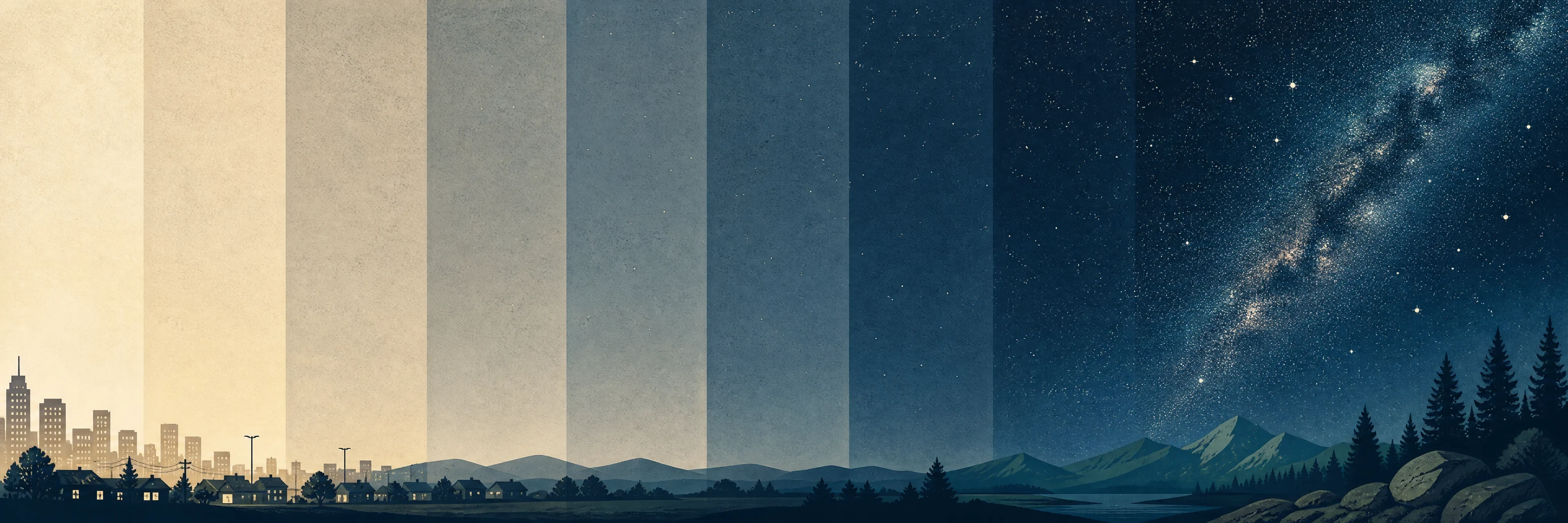
The Bortle scale rates astronomical light pollution from Class 1 (where the Milky Way casts a visible shadow) to Class 9 (where only the Moon and bright planets survive). Created by John E. Bortle in 2001, it translates subjective naked-eye limits into objective Sky Quality Meter (SQM) surface brightness measurements.
What does each Bortle class look like on the ground?
| Bortle Class | SQM (mag/arcsec²) | NELM Limit | Milky Way & Zodiacal Appearance | Est. Distance from Major City |
|---|---|---|---|---|
| Class 1 (Pristine) | 21.7 to 22.0 | 7.6 to 8.0 | Milky Way casts faint shadows; M33, gegenschein, and zodiacal band brilliant | >200 miles |
| Class 2 (Truly Dark) | 21.5 to 21.7 | 7.1 to 7.5 | Milky Way highly detailed; airglow weak at horizon; gegenschein visible | 100–200 miles |
| Class 3 (Rural) | 21.3 to 21.5 | 6.6 to 7.0 | Milky Way complex; light domes visible along low horizon | 60–100 miles |
| Class 4 (Suburban Transition) | 20.4 to 21.3 | 6.1 to 6.5 | Milky Way clear overhead but lacks fine structure; clouds lit above | 40–60 miles |
| Class 5 (Suburban) | 19.1 to 20.4 | 5.6 to 6.0 | Milky Way washed out or invisible near horizon; visible only near zenith | 30–50 miles |
| Class 6 (Bright Suburb) | 18.0 to 19.1 | 5.1 to 5.5 | Milky Way visible only near zenith; clouds bright across sky | 20–30 miles |
| Class 7 (Urban Transition) | 18.0 to 18.5 | 4.6 to 5.0 | Milky Way entirely invisible; sky background turns grayish-white | 10–20 miles |
| Class 8 (City) | 17.0 to 18.0 | 4.1 to 4.5 | Sky glows orange/white; newspaper text readable by ambient skyglow | 5–10 miles |
| Class 9 (Inner City) | <17.0 | ≤4.0 | Entire sky ablaze; only Moon, planets, and a few dozen stars visible | Urban Core (0–5 mi) |
How is Sky Quality Meter (SQM) surface brightness calculated?
Sky surface brightness is measured in magnitudes per square arcsecond (mag/arcsec²). To convert SQM measurements into physical International System luminance units (candela per square meter), researchers use the empirical conversion formula:
Luminance [cd/m²] = 10.8 × 104 × 10−0.4 × [mag/arcsec²]
A natural moonless sky floor of 22.0 mag/arcsec² equals roughly 0.17 mcd/m² (millicandela per square meter), while a pristine 21.6 mag/arcsec² sky emits ~0.25 mcd/m². Airglow fluctuations across the 11-year solar cycle naturally shift this baseline by 0.4 to 0.5 mag/arcsec² between solar minimum and solar maximum.
Standard wide-angle SQM meters feature an 84° full cone field of view, making them vulnerable to horizon glare. The SQM-L adds a lens that narrows the acceptance angle to a ~20° cone (10° HWHM), isolating zenith brightness and suppressing off-axis glare by a factor of 10.
Why do satellite maps miss modern LED light pollution?
Global satellite maps generated by the VIIRS Day/Night Band (DNB) sensor record a modest 2.2% annual increase in artificial radiance. However, citizen-science data from 51,351 Globe at Night observations published by Kyba et al. in Science revealed that human-observed visual skyglow is actually escalating at 9.6% per year—doubling brightness every 8 years.
Satellite Blindness (VIIRS DNB)
- Sensor has zero spectral sensitivity below 500 nm wavelength.
- Completely misses the 450 nm blue emission spike of broadband white LEDs.
- Measures only upward vertical light, ignoring horizontal facade spill.
Human Scotopic Sensitivity
- Dark-adapted rod vision peaks near 507 nm in the blue-green spectrum.
- Rayleigh scattering scales inversely with the fourth power of wavelength.
- 3000K warm LEDs amplify scotopic skyglow by +161%; 4000K cool LEDs by +216%.
How do snowpack and overcast clouds multiply city skyglow?
Urban light domes scale with city population via Walker’s Law (intensity proportional to population divided by distance to the 2.5 power). However, local weather introduces extreme multipliers:
- Overcast Clouds over Cities (10× multiplier): Low clouds bounce upward street light back to the surface, making urban cloud decks 10.1 times brighter than clear city nights.
- Snowpack Reflection (33× multiplier): Fresh snow cover reflects downward municipal light back up into the atmosphere, causing the phenomenon of "snowglow."
- Snow + Overcast Clouds (188× multiplier): Combining snowpack with a low cloud deck multiplies suburban zenith brightness up to 188-fold (yielding 0.79 lux, over twice the illuminance of a full Moon).
- Absolute Environmental Amplification (3,500×): Urban snowglow under overcast skies is 3,500 times brighter than an unpolluted wilderness sky.
How does light pollution penalize astrophotography integration time?
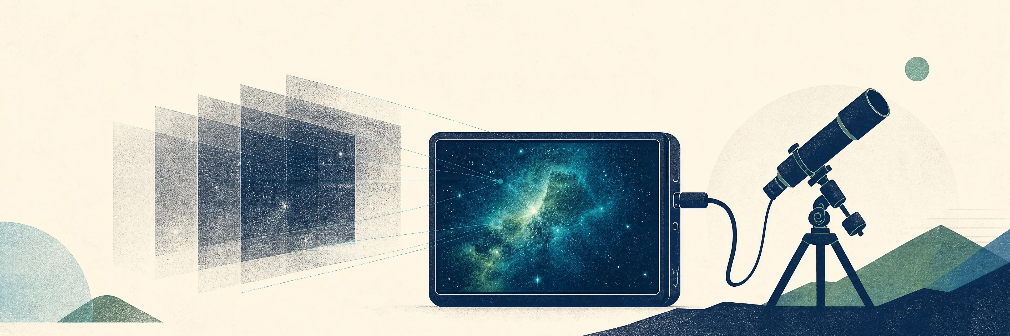
Camera sensors collect target photons alongside skyglow background shot noise. The integration time required to achieve a given Signal-to-Noise Ratio (SNR) scales exponentially as 2.5Δm, where Δm is the sky brightness difference in magnitudes.
Moving an imaging setup from a rural Bortle 4 site (21.0 mag/arcsec²) to an urban Bortle 7 site (18.5 mag/arcsec²) creates a magnitude gap Δm = 2.5. The required exposure penalty is 2.52.5 ≈ 10, meaning 2 to 4 hours of total exposure in a dark sky requires 20 to 40 hours of exposure in the city to achieve the same clean image detail.
Primary datasets: Falchi New World Atlas, Globe at Night Science Study, and Unihedron SQM-L Specifications.
Astro combines your location with live skyglow models so you know exactly which deep-sky targets are achievable.
Open the live sky